
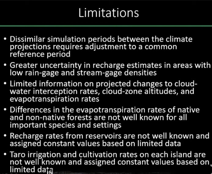
Photo: Limitations of recent U.S. Geological Survey modeling of aquifer recharge in Hawaiʻi. Credit: Heidi Kāne presentation to Commission on Water Resource Management.
By Teresa Dawson
How will the climate crisis affect groundwater recharge in Hawaiʻi?
As a presentation the U.S. Geological Survey gave to the state Commission on Water Resource Management last month illustrated, that’s not an easy question to answer.
The commission, through the development of its Water Resources Protection Plan, sets the sustainable yields for each aquifer system throughout the state.
Currently, those numbers do not reflect possible changes in rainfall due to global warming. But they soon may.
The data USGS geologists Heidi Kāne and Alan Mair of the agency’s Pacific Islands Water Science Center presented were admittedly preliminary and subject to revision, but the center is expected to publish final recharge modeling results sometime this year. And Water Commission staff are poised to incorporate those results into revised sustainable yield estimates.
To estimate future recharge, the USGS used statistical and dynamical downscaling models to predict rainfall under different greenhouse gas conditions. It then compared the results to a 1978-2007 “reference climate,” and fed those results into a water budget model.
Using the statistical downscaling model, the agency developed mid-century projections for the years 2041-2071 and projections for 2071-2099, which would reflect the driest possible outcomes.
Using two different Hawaiʻi regional climate models, which are considered dynamical models, the USGS developed projections for the years 2080-2099, each with a different greenhouse gas emission scenario.
For each island, they came up with six projections, then later whittled it down to three: one mid-century, one “wet,” and one “dry.”
Because there is no consensus on which type of downscaling model is better, statistical or dynamical, “it’s best, when you do a study like this, to include both of them so you get a very wide range of what could happen in the Hawaiian Islands for future climate conditions,” Kāne said. (Downscaling models are used to provide regional climate projections because global climate models only predict changes for very large areas.)
For all of the inhabited main Hawaiian Islands, island-wide recharge was expected to decrease under the mid-century and dry climate scenarios. That was also true for the wet climate scenarios for Kauaʻi, Molokaʻi, and Hawaiʻi island.
Lanaʻi was projected to see a decrease in recharge under the mid-century and dry scenarios, but was projected to see an increase in recharge of 5 percent under the wet scenario.
Water commissioner Mike Buck questioned how the wet scenario results showed Lanaihale, which is the forested center of the island, would see a decrease in recharge, while the non-forested areas would see an increase. Commissioner Neil Hannahs said it seemed counter-intuitive, given the ground cover.
Kāne admitted that she and Mair were not expecting that result. She said that a few months during the year with high episodic rainfall are driving higher projected recharge in the non-forested areas of the island.
Mair added that the disparity in the lowland areas could be due to a variety of factors, including how they estimated runoff — which was based on stream gage data from other islands.
The wet scenario for Oʻahu also projected an increase in recharge (1 percent), as did the one for Maui (11 percent).
Under the dry scenarios, decreases in recharge were projected to reach 55 percent for Lanaʻi, 29 percent for Kauaʻi, 24 percent for Oʻahu and Molokaʻi, 20 percent for Hawaiʻi island, and 14 percent for Maui. (Under a special drought scenario run for Lanaʻi, recharge was expected to decrease by 59 percent compared to a reference climate from 1998 to 2002.)
The Lahaina aquifer sector, which we discuss in our cover story and which commission staff believes should be designated as water management area, is projected to see a decrease in recharge of 19 percent by mid-century and 24 percent in the dry scenario. Under the wet scenario, it will see 4 percent increase in recharge.
The Pearl Harbor aquifer sector, which provides most of the potable water on Oʻahu, was projected to see a decrease of up to 21 percent under the dry scenario, and an increase of 2 percent under the wet.
The Keauhou aquifer system on Hawaiʻi island, which has also been considered for designation, is projected to see a decrease in recharge across all three climate scenarios, from 33 percent to 53 percent.
In the latter part of her presentation, Kāne threw a curve ball at commissioners. In addition to running the models to determine how changes in rainfall and runoff would affect recharge, her agency also developed projections that took into account potential effects warming and increased atmospheric carbon would have on evapotranspiration, and the subsequent effects on recharge.
Those projections found that recharge wouldn’t change all that much in either direction for all of the islands.
Commissioner Buck seemed dumbfounded.
“You presented this frightening data on decreases, then all of a sudden, it’s going to be offset by CO2 in the air? Where did that come from?” he asked.
Mair explained that some relatively new studies indicate that an increase in atmospheric carbon dioxide “offsets the effects of drying just from warming. … In some cases, it more than compensates, and you actually see an increase in recharge. … Plants transpire less and you have more water in the root cell that can become recharge.”
He added that those projections are “only accounting for that input, and not adjusting for other changes like rainfall, or daily rainfall frequency changes … The results that we showed you in the earlier slides were only accounts for that first input: only rainfall and seasonal runoff to rainfall ratios.”
Commissioner Aurora Kagawa-Viviani asked whether the USGS had considered the effects increased fire frequency would have on recharge.
Mair replied that that would require field data collection, which was beyond the scope of the water budget modeling study.
Commission chair Suzanne Case said she hoped all of the USGS results would be made available soon and called it “important work.”
“It’s just a strange world that we live in that the inputs on water is a huge uncertainty that we have to analyze like this. For all of humanity, we’ve been looking at the outputs — population, ag use, those kinds of variables,” she said.
Leave a Reply