
Above photo: A papamu, or konane stone, near the Road to the Sea in the Kaloko Heights area. CREDIT: ASM AFFILIATES, 2018
More than 40 years ago, the state Land Use Commission approved a petition to place 213 acres of land in Kona into the Urban land use district, paving the way for development of what was to be the first phase of a two-phase, 1,400-home project proposed by the Y-O Limited Partnership, covering a total of 407 acres. A small commercial area with a laundromat, gas station, and mini-market was to occupy around 5 acres along the roadway bisecting the two phases – now known as Hina Lani Street. The entire development was to be served by cesspools.
In the decision approving Y-O’s plan, the commission required it to submit within five years an application to reclassify the Phase Two land, consisting of 195 acres, into the Urban District. But as a condition of that, Y-O had to show it had substantially completed onsite and offsite improvements needed for both development phases. A recent staff report prepared for the commission notes that this would include “partial satisfaction of the conditions to provide affordable housing and dedicate land for public facilities, and full satisfaction of the conditions to construct a road connecting Queen Kaʻahumanu Highway and Mamalahoa Highway, and to complete water source development.”
For a number of reasons, including the failure of Lehman Brothers in 2008, the land changed hands several times and the succession of owners requested and received from the LUC multiple time extensions. The most recent time extension for filing the Phase Two application expired earlier this year.
The connecting road, known as Hina Lani Street, has been built as well as some of the water infrastructure. Almost 11 acres of land was donated to a non-profit, to comply with affordable housing requirements. But other conditions for applying for redistricting of Phase Two are still undone.
So now the current owners, a group of entities affiliated with Redwood Capital Finance Company (RCFC, LLC) and PCCP, LLC, are once more asking the LUC to extend the deadline for completing Phase One and applying for Phase Two approvals by ten years, to January 2033.
A lot has changed, legally, in the 40-plus years since the boundary amendment petition was first received by the LUC. Cesspools are absolutely not allowed, which has forced the developer to put in a couple of miles of sewer main linking the project site to the closest connection with the county sewer system, near the West Hawaiʻi Civic Center. Yet there has still been no environmental impact statement prepared for the project.
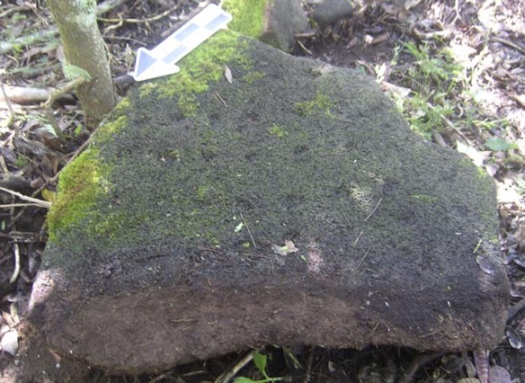
The Road to the Sea
The Kaloko Heights area was part of the vast Kona Field System, a remarkably productive area cultivated by Native Hawaiians before western contact. The northern part of Phase One is in the ahupuaʻa of Kohanaiki, while the southern portion – the part that now adjoins Hina Lani Street – is in the ahupuaʻa of Kaloko.
In 2005, an archaeological inventory study conducted by Thomas Wolforth described the Kohanaiki portion as “at the northern fringe” of the Kona Field System, “where the rainfall is just barely sufficient to sustain agricultural practices. … The ancient stories associated with this area emphasize water.” A number of caves in the area found by Wolforth and others are thought to have served as sources of fresh water.
Wolforth identified 89 significant archaeological sites, including agricultural features, those caves for water collection, permanent and temporary habitation sites, petroglyphs, a heiau with a burial, and seven other burials. Melanie Chinen, then administrator of the State Historic Preservation Division (SHPD) agreed with Wolforth’s recommendation that 26 of them merited “data recovery” and that 11 others should be preserved.
One of prominent features of the site, one that appears in maps dating back to the earliest mapping efforts of government surveyor Joseph Emerson in 1882, is a road or trail leading from Kaloko Mauka down to the coastal fishponds. Despite its clear significance, Wolforth recommended that it not be preserved, stating that it had been compromised by use as a jeep road by soldiers stationed on the island during World War II.
Chinen agreed, accepting Wolforth’s recommendation of “no further work” for the Road to the Sea or Kohanaiki Road, as Emerson called it, which was labeled site 10714 in Wolforth’s survey. “We appreciate the effort of your staff in their research and consultation with persons knowledgeable about the significance of the Road to the Sea,” Chinen wrote. “Your research confirms that this historic trail was used by area residents to traverse from their homesteads to the sea, and later adopted for use by soldiers during WW II. Although many of the native Hawaiians you consulted with expressed their wish that this road be preserved, we agree that this is not feasible as the road has lost its integrity. In addition to the modifications made by WWII soldiers, the makai section of this road has been breached with many sections of it either destroyed or nearly destroyed.”
Despite Chinen’s apparent willingness to abandon the road, Na Ala Hele, the branch of the Department of Land and Natural Resources that administers state trails, was not prepared to give up.
In February 2005, Doris Moana Rowland, an abstractor for the state, wrote Irving Kawashima, a trails specialist for Na Ala Hele, listing all of the registered maps that showed trails and roads running across the Y-O Project area.
Rowland concluded: “The numerous land grants and Land Commission Awards within Kohanaiki and Kaloko indicate the presence of many residents who would require pedestrian access from the uplands to the coastline and adjoining ahupuaʻa. … Based on the available evidence pursuant to the Highways Act of 1892, the state of Hawaiʻi through its Board of Land and Natural Resources may claim a fee simple interest in the trails and roads. … It is recommended that a modern metes and bounds survey description of these trails be completed and all adjoining landowners be notified of any future management plans of these historic publicly owned features.”
Representatives of the developer at the time, Stanford Carr Development, LLC, then met with the Big Island Na Ala Hele Advisory Council, proposing that the landowner purchase and “functionally realign” that portion of the Road to the Sea within the Kaloko Heights area and then grant an easement for public pedestrian access within the “walkways and greenspace areas along the functionally realigned” road. The advisory council and members of the Kona community rejected the request.
But by November 2006, an agreement had been reached. This was memorialized in a letter to county planning director Christopher Yuen from Paul Kay, vice president and senior development manager for Stanford Carr.
Referring to the road as the Kohanaiki Trail, Kay informed Yuen of “recent developments between ourselves and a community group consisting of certain ʻohana members from the area.” A consensus was reached, he said, on a number of points.
Among them: “the original mauka-makai alignment (‘footprint’) of the Trail and public use and interests thereof shall be retained in perpetuity across the subject property.” Also, the trail would be at least 10 feet wide, with 10-foot-wide buffers on either side. The ʻohana members agreed to allow roads within the development to cross the trail, so long as pahoehoe stones from the project site are embedded in the roadway paving and in no case would there be more than four crossings.
Easements
In June 2007, the then-landowner, Kaloko Heights Associates, LLC, petitioned the Land Board for four easements across the trail, each approximately 10 feet wide and 80 feet long. The staff report, which recommended approval of the easements, stated that this part of “The Road to the Sea was demolished by the U.S. Army during World War II… The State Historic Preservation Division has determined that preservation of this portion of the Road to the Sea is not required. Notwithstanding the poor physical condition, members of the [Na Ala Hele] Advisory Council and interested Kona community members have expressed the notion that given the historical value of the trail, even the extremely disturbed portions should remain in place to insure the historical integrity of the route.”
Regarding ownership of the trail, the staff report stated, “Applicant and the State have agreed, for the sole purpose of this transaction, to ‘agree to disagree’ on ownership of this portion of the former Road to the Sea.” It is not clear whether the Land Division, which prepared the report, meant to say that the state was claiming or disavowing ownership. In any case, however, “for title purposes the transaction is being processed under the same provisions applicable to a purchase of state lands.”
The Land Board approved the easements, amending it to include the letter from Kay to Yuen setting forth the terms of the agreement hammered out with Na Ala Hele and community members.
Seven years later, on February 28, 2014, the Land Board was asked to amend the prior grant of easements, changing the name of the landowner to RCFC Kaloko Heights, LLC. As it turns out, the original easement documents were never executed. “For reasons unknown,” the staff report states, “the documents were misplaced twice, requiring the Department of Attorney General to reprint the documents. When staff sent the third set of documents to KHA for execution, staff was informed that the interest of KHA in the private property benefited by the easements had been transferred… As a result, staff is now recommending that the Land Board authorize a change of the grantee from KHA to RCFC Kaloko Heights, LLC.” The amendment was approved.
Fast forward eight more years, to September 2022. By this time, the landowner’s plans had changed such that a 100-unit affordable housing project was going to be built in the lower portion of the Phase One area, with the trail now bisecting a proposed parking lot. This necessitated relocating one of the four easements. The Land Board granted the request, which was formally recorded with the Bureau of Conveyances only on March 17.
Originally, the easement that now is located in the affordable housing parcel had been located in the area where the proposed Holo Holo Street extension (dividing the affordable parcel from the market-rate area) is supposed to cross the trail. The remaining three easements are all within the market-rate area.
Current plans show access into the market-rate area by means of two streets branching off Holo Holo, on the west, and Hina Lani, on the south. Both entries are to be gated. Without any provision for public parking, it is unclear how the public can have access to the trail as it passes through the market-rate subdivision.
Affordable Housing
The 1983 LUC decision required 10 percent of the total number of lots or homes developed be affordable to low- and moderate-income residents. The condition was amended in 2016 to allow RCFC to donate land to a non-profit organization, the Hawaiʻi Island Community Development Authority (HICDC) which would undertake the actual construction and management of the affordable units. The 10 percent quota remained, however.
The land, consisting of around 11 acres just inside the makai (western) border of the Phase One property, was conveyed to HICDC in 2017. To satisfy requirements for financing, an environmental assessment was prepared. The State Historic Preservation Division also wanted an updated archaeological inventory survey that would provide “updated information regarding the condition, integrity, and historic preservation status for the sites” within the parcel that had been identified in the earlier study.
The update found a ceremonial complex that had not been previously identified. “This ceremonial complex is evaluated as significant under multiple criteria … and preservation is the recommended treatment.” A burial vault was also found, with preservation recommended. (No update has been performed, nor has any been requested, for the portion of Phase One land that was not transferred to HICDC. Nor has the larger project undergone any environmental assessment or environmental impact statement.)
The $54 million project will provide 99 units for households earning from 30 to 60 percent of the area median income. Units are expected to be completed by early next year.
A Community Facilities District
RCFC says that the total investment that it and predecessor companies have made to date in the Kaloko Heights development comes to more than $22 million.
That, coincidentally, is the same amount of the bond that the county has agreed to issue to cover the cost of installing roughly two miles of sewer line to connect the development to the county’s wastewater system. The gravity line will run initially from the affordable housing project down Hina Lani Street to its intersection with Ane Keohokalole Street, then south to the West Hawaiʻi Civic Center, where it will connect into an existing sewer main.
Sewers weren’t part of the original plan. Instead, the lots were to be served by individual septic systems. That is no longer possible. Now the entire subdivision must be served by an approved wastewater treatment plant.
To address the issue, RCFC has entered into an agreement with the county that establishes a Community Facilities District as a means of financing the wastewater line. The bonds issued by the county to finance the improvements will be paid off by a tax imposed on the owners of the Kaloko Heights land (not including the affordable housing portion) and collected by the county.
In November, the County Council approved issuance of up to $14.425 million in Special Tax Revenue Bonds to finance the initial work on the sewer line. According to HICDC’s report to the Hawaiʻi Housing Finance and Development Corporation, the construction contract has been signed and the notice to proceed is to be issued within five days of the bond sale closing.
— Patricia Tummons
Fun Facts
The attorney representing RCFC before the Land Use Commission is William W.L. Yuen. In 1983, when the LUC approved the redistricting petition of Y-O Limited Partnership, Yuen was its chairman.
RCFC is no stranger to controversy in the islands. Keen-eyed readers may recall our report on its involvement in the Kehalani development in Wailuku, Maui. There it sold off the land that was to be used for affordable housing to an individual patently unqualified to develop it. For details, see “Exactions in Original LUC Order Hang Up Effort to Split Maui Project,” in the February 2021 edition of Environment Hawaiʻi.
Leave a Reply