
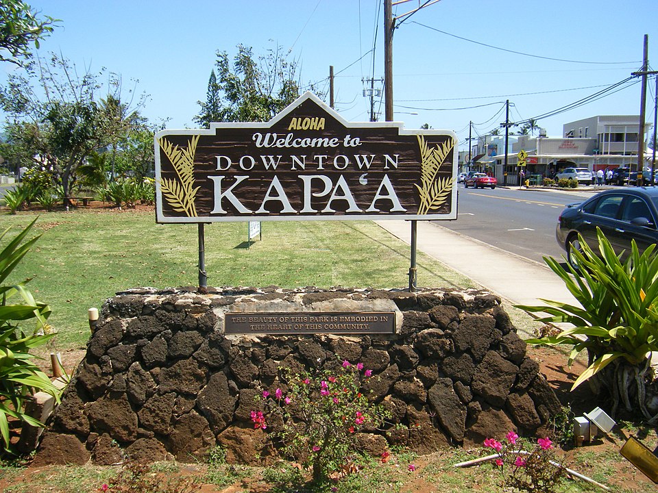
The state Land Use Commission is holding hearings on a boundary amendment petition to place about 96 acres of former cane land near Kapa‘a, Kaua‘i, into the state Urban District to allow for one of the largest – if not the largest – new housing developments yet proposed for the island.
The landowner, HG Kaua‘i Joint Venture, LLC (HGKJV), is proposing that 69 of those acres be developed into lots for 86 single-family homes, about 13 acres for 683 multi-family units, and about 13 acres for roadways, parks, and other open space. About 54 acres of the rest of the parcel is to be divided into 16 agriculture lots, in Phase I of the HoKua Place development. A solar farm producing about 1.18 megawatts of power occupies about four acres of the Agricultural land. Finally, about seven acres of the property that now lies under the Kapa‘a Bypass road is to be transferred to the state.
The boundary amendment petition was first brought to the LUC in November 2011 by then-owner Three Stooges, LLC, which proposed calling the development Kapa‘a Highlands. In 2013, HGKJV obtained the deed through foreclosure and subsequently was granted status by the LUC as Three Stooges’ successor in the boundary amendment petition. HGKJV also changed the nameof the project once more – to the oddly orthographic HoKua Place. (When the company’s CEO, Jake Bracken, was questioned about the name, Bracken admitted he had no idea what it meant nor did he know if it had any connection to the place at all. “One of our original consultants suggested it was meaningful to the area,” he said. He couldn’t remember the consultant’s name.)
In May 2015, former director of the state Department of Land and Natural Resources Peter Young prepared the first draft environmental impact statement (DEIS). But when the final EIS was filed in March 2018, the LUC staff “identified several issues with the filing and the petitioner voluntarily elected to withdraw the document, make corrections, do additional work, and resubmit in the future,” according to the LUC’s website.
In November 2018, a second DEIS prepared by Ron Agor of Agor Jehn Architects explained that the first DEIS was shelved, “due to the passage of time and intervening events,” including an updated traffic impact analysis, an invertebrate survey, and an updated county General Plan.” The second final EIS was published in November 2019, and a month later, the LUC accepted it as complete, albeit with many commissioners expressing reservations about the quality of the information in the document – and commissioner Gary Okuda voting to reject it.
In August 2020, HGKJV submitted an amended petition, which launched the latest chapter in efforts to put the subject acreage into the Urban land use district.
After preliminary hearings to take testimony and approve as an intervenor Liko Martin, the only party to formally file for intervenor status, substantive hearings on the petition were finally launched.
Community Sentiment
On March 10, the LUC received testimony from more than 150 individuals, nearly all of whom were opposed to the project. Many of them had already made known their feelings about the project in comments on the second draft EIS.
Traffic was a paramount concern for many commenting on the draft EIS. In replying to their letters and emails, Agor was often breezily dismissive.
“We can’t use traffic, growth, infrastructure needing work, as an excuse to deny these families from ‘having.’ People can enjoy life on Kaua‘i if they only can relax. Relax in traffic. It’s an island where are you going?” he told one woman.
In response to another commenter who noted that “traffic is out of control!” Agor suggested that sitting in traffic “is a noble cause if 231 families have the opportunity to have a very affordable home.” (The developer has said that, to satisfy Kaua‘i County requirements, 231 of the multi-family units will be sold at prices considered affordable to families earning from 80 to 140 percent of the area median income, or priced between $175,000 and $275,000 at present.)
In another reply, Agor told the commenter that “you may be one of those who came to visit and forgot to go home. Thus, being the biggest contributor to the problems you are noting.”
To a teacher who objected not only to traffic that would be created by the proposed development, but also the outdated wastewater treatment facility, Agor replied that she was “selfish and unreasonable.” “You can certainly compromise with the those [sic] who want this project by staying home in peak traffic hours,” he said.
In numerous replies, Agor praised the developer who, he said, had first planned to subdivide the entire parcel into small farm lots. But, being pressed by a former county planning director to build affordable houses, Agor said, the developer “walked away from the big bucks” and proposed what became known as HoKua Place instead. In response to comments from Rayne Regush, representing the Sierra Club Kaua‘i Group, Agor identified the planning director as Ian Costa, who resigned in 2010. Given that time frame, the then-developer most likely would have been represented by Greg Allen, who now has an equity position in HGKJV.
Agor repeatedly referred to the 2018 update of the Kaua‘i General Plan – “forged by the people of Kaua‘i” – which identified the HoKua Place area as “neighborhood general.” The designation is a new one, intended to apply to areas within “walksheds” (10-minute walks) of neighborhood centers, such as Kapa‘a town. Agor does not mention, however, that the people of Kaua‘i who engaged in the planning process were strongly divided over the inclusion of HoKua Place as an area designated for growth. “Community opinion remains divided,” the General Plan narrative states, “with strong concerns about the perceived impacts of the proposed development on traffic.”
As for walkability, the proposed development is on a plateau above Kapa‘a town proper. The town may be a 10-minute walk from the planned intersections leading into the development, but that walk is along narrow roads with steep grades. So far, HGKJVhas not committed to installing offsite improvements, such as sidewalks or bike lanes, that would make the trip safe for bicyclists or pedestrians.
Complicated Ownership
Efforts to subdivide the parcel date back at least to the late 1990s, when the then-owner, Moishe Silagi, a California developer, proposed a subdivision called Kaua‘i Highlands. Silagi then sold the land to Kapa‘a 160, LLC, which proposed a large-lot development to be called Kulana Kai. Kapa‘a 160’s principals, William Hancock and James Lull, held a 70 percent interest in the land, while The Allen Family, LLC acquired 20 percent and Moloa‘a Bay Ventures, LLC, acquired 10 percent.
Kapa‘a 160 then sold a share of their interest to The Three Stooges – of which Lull was himself a member, along with Greg Allen Sr. and Greg Allen Jr. (Greg Allen Jr. later described all of the Three Stooges as family members.) Kulana Kai was renamed Kapa‘a Highlands.
In early 2001, Kapa‘a 160 had given a mortgage to Kaua‘i lawyer Kurt Bosshard. (Bosshard is also the principal of the firm that owns the solar farm on the part of the HoKua lot that is to remain in Agriculture.) After a series of loan modifications, Bosshard ended up being owed approximately $4 million. In early July 2012, he filed a foreclosure action against the landowners, which ultimately led to the property being sold at auction.
But Bosshard was not the only mortgage holder. In 2002, the Allen Family had filed at the Bureau of Conveyances a subordinate mortgage given it by Kapa‘a 160 and Moloa‘a Bay Ventures. The mortgage noted that the Allen Family had contributed $1.51 million in return for its interest in the property, and that it was now placing a second mortgage on the property “to ensure that, in the event Kapa‘a 160 defaults on the note,” the company would have a lien on the property.
After the judgment in favor of Bosshard, the Allen Family asked the court to allow the holder of a second mortgage to file a credit bid when the property was auctioned. On March 6, 2013, the same day as the auction, the Allen Family assigned its mortgage toHG Kaua‘i Joint Venture, thus allowing that company to submit a credit bid as the second mortgage holder. Placing the bid was Greg Allen Jr., who identified himself now as a member of HGKJV.
In testimony to the LUC, Jake Bracken, CEO of the company, said the actual price paid for the land was $10.6 million; the company had acquired a “second position note,” he said, which was used as a credit bid after Bosshard’s claim had been satisfied.
When asked to identify the members of the LLC, Bracken said the ultimate owner is Robert Roche and his family. HGJKV “is owned mostly by an entity named HG Kaua‘i, which is his, the Roche family, interest. And a little by an entity Steam Investments, where the Allen family has their interest,” Bracken said. He added that he and another individual had “contingent interests” in the neighborhood of one or two percent.
HG Kaua‘i Joint Venture is one of hundreds – if not thousands – of business entities across the globe whose ownership traces back to Roche. These involve not just real estate holdings or housing developments but also import-export businesses, media distribution, hotels, and much more.
On May 19, 2014, HGKJV gave a mortgage to HG Kaua‘i, registered in Nevada, in return for a $500,000 loan, at 10 percent annual interest. Both companies share the same address, in Hickory Hills, Illinois; the same email contact; and the same phone number. Signing for HGKJV was Theresa Roche (Robert Roche’s sister). When HG Kaua‘i agreed to have that mortgage subordinated to a much larger mortgage that HGKJV gave to Goldman Sachs in 2020, Theresa Roche signed on behalf of HG Kaua‘i as well.
That Goldman Sachs mortgage secures a loan agreement that provides funding of up to $5 million – not to HGKJV alone, but also to an entity called Hurricane Hills Ranch Estates, LLC, registered in Utah. Once more, Theresa Roche signed the loan agreement as representative of Hurricane Hills as well as HGKJV.
According to records of the City of Hurricane, Utah, Hurricane Hills Ranch Estates has submitted a preliminary plat plan for a 216-lot single-family residential development to be known as the Estates at Sand Hollow. The city council gave conditional approval to the plan in February.
In a filing last November made in support of the company’s financial ability to carry out the project, HGKJV listed the Goldman Sachs mortgage as well as a line of credit of $15 million issued by Arboretum Holdings Corporation of Nevada (president, Robert Roche). The $500,000 mortgage held by HG Kaua‘i was not mentioned.
While the EIS and other filings are silent as to the cost of the project, engineering consultant William Bow provided in his testimony a back-of-the-envelope estimate of the cost of backbone infrastructure (roads, utility lines, and the like). His estimate for infrastructure alone was about $82 million, while the total project costs he placed at more than $300 million.
A longstanding concern of the LUC has been the use of the redistricting process as a means of adding value to land whose owners then flip the property, without developing it in accordance with the conditions of the redistricting.
Commissioner Gary Okuda asked Bracken about this: “Since Mr. Roche seems to be the person with the money controlling these entities, is he willing to personally guarantee all the representations and promises you are making?”
Bracken was noncommittal: “I need to address this with him. We haven’t discussed that.”
“What assurances do we have that these representations and promises are going to be made?” Okuda asked. Would, for example, HGKJV be willing to agree to the condition that the property will not be sold until all representations have been completed?
Bracken replied, “The concern I have is, putting my accounting hat on, often we will make a change in ownership internally, moving – capital gains versus ordinary income rule. I hesitate to answer right now, since that might conflict with future loan covenants or something else. … Obviously, we’ve put millions into this property right now. I’m just a little hesitant that we might be in conflict with another loan contract, inadvertently. But we’re willing to have some sort of discussion about how we could make these assurances.”
In recent hearings on several LUC dockets, commissioner Dawn Chang has brought up the suggestion that the LUC could require the posting of a performance bond to ensure basic commitments are developed. When she asked Bracken if he would be willing to put up a bond, he hedged. “Before I make a commitment here today I would like to understand it better.”
Chang then asked that following talks with counsel, “you come back and give us what you would suggest, … what would be an appropriate performance bond.”
Climate Change
Under recently adopted rules, the Land Use Commission now requires petitioners to assess climate-change related threats to the proposed development as well as how to mitigate them. The analysis has to look at such things as the impact of sea-level rise, effects of climate change on infrastructure (including roads, sewer, and water lines), and a description of the overall carbon footprint of the project.
The HoKua Place petition is the first to come before the LUC under the new rules. To conduct the required assessments, HGKJV enlisted the help of G70 (the Honolulu firm formerly known as Group 70). The task fell to G70 employee Cody Winchester.
Winchester had conducted his assessment by making certain assumptions about where future residents of the development would work and shop, then plugging them into the California Emissions Estimator Model (CalEEMod). When specific data were not available, default numbers provided in the model were plugged in.
Bottom line, as estimated by Winchester: over the 30-year expected life of the project, the annualized carbon-dioxide equivalent emissions attributable to HoKua Place are between 7,116 tons (if mitigated) and 7,928 tons (unmitigated). Factoring in the loss of carbon from vegetation that was removed and the addition of new plantings (300 trees, estimated), total annualized emissions came to 7,380 (using the mitigated carbon emission estimate). With a population of 2,408 individuals, Winchester put the annual per-capita emissions of CO2 equivalent gases at 3.06 metric tons. He concluded that the proposed emissions would not interfere with the state’s goal of reducing emissions below 1990 levels.
Okuda had a series of questions about the assumptions Winchester had made. “Did you ever see any material prepared by the developer or anyone else that set forth or documented where the intended residents of this development would go for work?” he asked.
“I believe the intention of building the community where it is is because of its location and a town center, Kapa‘a,” Winchester replied. “And recognizing that Kapa‘a is a more urbanized area, especially for Kaua‘i, with employment opportunities, with schools, a hospital, that the intention was for folks to be using those amenities in Kapa‘a and making most of their trips to Kapa‘a town.” Did Winchester ever see anything in the record about where HoKua Place residents would work, Okuda asked.
“I’m not aware of a document like that,” Winchester answered.
“Did you see any document or study or other materials in the record which documented where and what type of retail people who live in the development would frequent or go to? My understanding is there’s no Costco in Kapa‘a town and other similar big-box locations are elsewhere, and Wilcox Hospital is not in Kapa‘a either. Is there anything in the record that sets forth … or provides data as far as what retail or other non-employment destinations the people who are expected to live in the development are going to?”
Winchester acknowledged he was not aware of any such document.
Had Winchester seen any evidence about actual employment opportunities in Kapa‘a and how much they pay? Did he ever see anything in the record to support the idea that the residents would in fact do most of their retail shopping in Kapa‘a and not Lihue?
No, Winchester said, he had not. “I can only speak to what the intentions of the project is, in determining its location,” he said.
Under further questioning from Okuda, Winchester admitted he had not read the full environmental impact statement and had no opinion as to the adequacy of a traffic report. “Sorry, I don’t have an opinion,” he said. “I was just asked to do a very narrow task. Making judgments about the traffic study was outside what I was scoped to do.”
Winchester’s assessment assumed that the development would include multi- modal (or “multi-model,” as the report puts it) transportation options – allowing residents to walk or bicycle when running errands, putting in bus stops, and the like.
Commissioner Nancy Cabral asked him whether he thought it would be possible to walk or bicycle to Kapa‘a.
Winchester said he thought so, though later he admitted he had not visited the area.
Commissioner Dan Giovanni, representing Kaua‘i, pressed him on his assumptions about bicycling and walking options. “You said it would be easy to connect to Kapa‘a town,” Giovanni reminded Winchester. “What is an easy connection?”
“I suppose it would be easy for the user, the desired result, so users would easily be able to bicycle or walk from the development to town and back. Not necessarily easy to develop.”
“What’s an easy connection across the Bypass Road?” Giovanni inquired.
“I know complete streets is something that was – complete street practices would be implemented as part of the project. That’s something the EIS states. I’m not a traffic engineer. It’s outside my expertise,” Winchester responded.
Giovanni: “My takeaway is you don’t know how easy or uneasy it would be to get to town from HoKua Place.”
Winchester: “We assume that a seamless bike lane going from Kapa‘a town would be implemented and it would be easy for the users. That’s the assumption made in the model.”
Giovanni: “By seamless, do you mean it wouldn’t stop traffic on the Bypass Road?”
“I don’t know,” Winchester said. “Sorry.”
Does this project increase or decrease the options of coastal retreat for Kapa‘a? commission chair Jonathan Likeke Scheuer asked.
“Having homes available in the mauka area … would allow residents in that zone to retreat upwards if desired,” Winchester said.
Sea-level rise studies, however, show significant potential inundation not just for residences but for major infrastructure and the commercial core of Kapa‘a, Scheuer said. “So will the use of this land primarily for residential development increase or decrease the possibility for coastal retreat options for the county?”
“I think designing this area outside the area of sea level rise is responsible,” Winchester replied. “And it is an encouraged project, as far as not building it in a vulnerable area.”
Traffic
Jammed-up traffic in east Kaua‘i is so notoriously bad it has earned its own name: the Kapa‘a crawl. The main road, Kuhio Highway, is coned for most of the morning to facilitate travel in the southerly direction, toward Lihue.
The Traffic Impact Analysis Report – TIAR – included in the final environmental impact statement was based on traffic surveys done in March 2017. The author, Randall Okaneku of The Traffic Management Consultant, noted that in the four years between the first traffic study, done for the first EIS in the 2012-2013 time frame, and his study, traffic had increased by 12 percent in themorning peak hour and by 22 percent in the afternoon peak hour.
When Okaneku presented his study to the LUC in April, Chris Donohoe, representing the Kaua‘i Planning Department, noted that the traffic might have increased even more in the four years since Okaneku’s report.
In addition, of the seven traffic improvement measures that Okaneku’s report said would be undertaken even without HoKua Place being developed, four of those should have been excluded, Donohoe said, “because they’re either not achievable or will have no impact on traffic.” One of those assumed improvements was the elimination of parking on Kuhio Highway as it passes through Kapa‘a. This “would have severe economic consequences on commercial activity and have a severe impact onpedestrians,” he said.
As proposed by HGKJV, the main road through the development – Road A – will join up with Olohena Road on the north, just mauka of the Kapa‘a Middle School, by means of a T-intersection, with a stop sign on Road A. On the south, Road A would intersect with the Kapa‘a Bypass by means of a roundabout.
While neither the county Planning Department nor the state Office of Planning, which is another party in the LUC hearings, has objected to the redistricting, both cite the need for an updated traffic analysis as a condition of LUC approval. The Office of Planning recommends as conditions of approval a number of offsite traffic improvements, including, among other things, the construction of a roundabout at the intersection of Kapa‘a Bypass at Road A; the widening of the roundabout as the junction of the bypass and Olohena Road; and the widening the Bypass Road north of Olohena to accommodate traffic in both directions. Only the construction of the T-intersection at Olohena and the new roundabout at the intersection of Road A and the Kapa‘a Bypass is anticipated in the backbone infrastructure budget prepared by Bow for HGKJV.
Wetlands
Throughout the series of draft environmental impact statements, beginning in 2014, and up to the final EIS in 2019, no mention is made of any wetlands on the HGKJV property that would require protection from future development.
However, as the Office of Planning noted in its position statement, in 2018, the U.S. Fish and Wildlife Service’s National Wetlands Inventory identified 3.3 acres of wetlands on the property subject to the boundary amendment petition and another 5 acres on the part of the parcel that is intended to remain in the Agricultural land use district.
Bow, the consulting engineer for HGKJV, testified that he had been asked to prepare an analysis of water and wastewater issues after the final EIS was published, and that he had concerns about some of the analyses included in that document –specifically, the placement of a detention basin in the wetland area, the handling of stormwater and the analysis of the contribution of stormwater attributable to the development.
“I didn’t like that idea, so I redesigned it and pushed it [the basin] within our site,” he said.
Commissioner Okuda asked whether the failure to include mention of wetlands in the EIS as well as Bow’s updated drainage analysis might require publication of a supplemental EIS. The drainage report in the final EIS, Okuda noted, was dated July 2011. “Your drainage analysis was prepared in February 2021, which is almost 10 years after the drainage report made a part of the final EIS, correct?” Okuda asked Bow.
Bow agreed.
Okuda: “Was your drainage analysis at any time ever submitted as a supplement to the final environmental impact statement?”
Bow: “Not to my knowledge.”
Okuda: Did anyone even discuss the possibility of submitting your analysis as a supplement to the final EIS?”
Bow: “I believe we talked about it, but we were so far along. I was told they were so far along with the EIS that the changes we were working on were not material to the EIS.”
Agriculture
For more than a century, the land proposed for the HoKua Place development was profitably cultivated in sugar cane. The last harvest was in the 1990s, however, as sugar was in decline on all the islands.
David Rietow, owner of Agricon Hawai‘i, Inc., was retained by the developer to assess the suitability of the land for agriculture. More than a decade ago, he had been hired by the then-owners to prepare an agricultural plan for a future large-lot agricultural condominium regime for the entire 163-acre parcel. His plan, developed to address the requirement that commercial agricultural activities be undertaken by owners of farm lots, anticipated the homeowners’ association raise goats. Each owner could have a few goats, with the association being responsible “for the rotation, care, and marketing of the animals. … As an alternative, the association could hire an independent contractor to operate the project.” That plan remained in the final EIS, along with Rietow’s 2018 report on the agricultural suitability of the 96-acre fraction of the land now proposed for redistricting.
In questioning Rietow, HoKua Place attorney William Yuen limited his examination to that more recent document. Asked by Yuen for his conclusions about the suitability of the property for agriculture, Rietow cited “a wind problem, a salt-air problem. The land itself is not flat, has some slopes and what have you in it. Right now, it’s got a bigger problem – it’s right next to the Kapa‘a Middle School and residential subdivisions.” Complaints from residents over dust and pesticide drift from crops would make farming in the area difficult, he contended.
Rietow went on to describe available lands elsewhere on the island: “About 140,000 acres of land are classified for agriculture. I think there’s 63,000 acres in some sort of agriculture, most of it being livestock. A little over 2,000 acres that are in food production, primarily taro and tropical fruit, which leaves about 76,000 agricultural land on Kaua‘i that’s not being farmed.”
The preferred area for farming, in Rietow’s view, is on the western side of the island, where land is flatter and the area is not as populated.
Referring to the 96 acres proposed for HoKua Place, Rietow said, “if you take it out of agriculture and put it in residential, there’s going to be absolutely a minimal impact on Kaua‘i’s ability to feed its population.”
Donohoe, representing the county, challenged Rietow on several of his statements. “Doesn’t the west side have issues regarding spraying, dust, chemicals near residences and in the vicinity of Waimea Canyon Middle School? Wouldn’t those present the same issues” as Rietow identified with respect to HoKua Place?
Rietow acknowledged the point, but added that there’s still more open land on the west side.
Bianca Isaki, one of the attorneys for intervenor Liko Martin, asked if Rietow were aware of what was now being farmed in the Kapa‘a area. He answered in the negative. Given his concerns over salt spray, Isaki asked if Rietow was aware of a number of crops with a high salt tolerance, including beets, bell peppers, tomatoes, broccoli, cabbage, kale, and spinach. “Every crop has its own issues with salt spray. In many cases, it isn’t a huge problem, but if you can farm on land that isn’t hit with salt spray, you’re better off,” he replied.
She listed even more crops that were resilient to wind.
Rietow replied by mentioning a study he had done on orchard crops, showing that trees did better with a windbreak than those without. The study, he added, was based on macadamia nut trees.
Isaki asked if he was aware of farming activities in the areas around Kapa‘a. He said he was not.
Would growing food on parcels close to residential areas reduce transportation costs to consumer markets? she asked. “Sure,” Rietow responded. “But you have much more flexibility with your farming if you don’t have a school near you or residences around you. … But you’re limited in what you can do if you’re around a school or residences.”
Had Rietow ever been involved with goat farming? she asked. No, he hadn’t, he replied.
Commissioner Chang followed up with her own questions about the limitations cited by Rietow. “When you refer to agricultural use, you assume herbicides, pesticides, spraying,” she noted. “But can other crops be grown without use of those chemicals?”
Rietow agreed. “It’s more costly, but I know people who do not use pesticides or any of that and do fine.”
Couldn’t you have small farmers interested in organic crops? she asked.
“You can do a lot of things with the land if you’re willing to spend the money,” Rietow replied.
Commissioner Okuda took his questioning of Rietow in a different direction.
“The landowner here has a portion of the property – which is larger than the petition area – designated as HoKua ag lots. Are you aware of that?” Okuda asked.
“Vaguely,” Rietow answered.
“Are you aware that the Land Use Commission has long ruled that to have a dwelling on agricultural land, the dwelling must be a farm lot or a dwelling otherwise authorized essentially for ancillary or support of bona fide agriculture. Are you aware of that?”
“Vaguely,” Rietow replied.
“Let me read just one paragraph from … [Declaratory Ruling 83-08],” Okuda continued. “It deals with use of property in the Agricultural district. It’s a DR order that was signed September 8, 1983. And actually it was signed by Mr. Yuen, who at that time was the chairman of the Land Use Commission.
“Let me read the very last paragraph of that order, because it goes to my question regarding the proposed use of property by the petitioner here: ‘Based on the above, the Land Use Commission rules that a single-family dwelling can be defined as a farm dwelling only if the dwelling is used in connection with a farm where agricultural activity provides income to the family occupying the dwelling and that a single-family dwelling whose use is accessory to an agricultural activity for personal consumption and use only is not permissible within the land use Agricultural district.’”
Rietow said he was aware of that.
Okuda: “More colloquially, it is not permissible simply to have a papaya tree if the fruit isn’t sold commercially. … So my question is basically this: Assuming that these ag lots are not going to involve people skirting the rules, putting up the bogus papaya tree and bogusly making representations that somewhere down the road there’s gonna be an income crop – in other words, assuming the owners are going to strictly comply and in good faith comply with the 1983 order — … what kind of crops are going to be grown on those HoKua ag lots?
“And my second question is, what evidence in the record is there that the crops that could be grown on the HoKua ag lots cannot also be grown on the land that’s in the petition area?”
“You can grow something on any size of land you want to grow it on,” Rietow said in response. “As long as you’re earning quote income from it, then it becomes a farm.”
Okuda: “I care whether or not there’s compliance with the law. Looking at the plan that’s being presented here, if we assume your testimony about the inability to really conduct agriculture on this property is the credible testimony, does your testimony in fact indicate that these ag lots are really a subterfuge undermining an order that Mr. Yuen himself signed in 1983?”
Rietow: “We’re getting off the track a little bit here.”
Okuda: “Oh, no. I think this is relevant to us determining the credibility of the presentation.”
Rietow: “You can do an awful lot of things with an awful lot of pieces of land. As a farmer, I go to the area that will give me the most income. Therefore I can create a profit.”
Chair Scheuer asked if Rietow was aware of the farming done by the Waipa Foundation, in Halele‘a, a district on Kauai’s north shore.
“Vaguely.”
What about the Common Ground Food Hub in Halele‘a?
“Not really.”
The Kilauea Agricultural Park? “Um. No, I’ve heard these names but have had no contact with them.”
Scheuer: “While certainly people from the west side might embrace your fondness for the west side, people from Halele‘a might have some concerns about your dismissal of Halele‘a as an important place for food on Kauai.”
“Okay. I got it.”
Future Hearings
So far, the hearings have not included any of the witnesses that the county, the Office of Planning, or the intervenor have listed. In addition, HGKJV has yet to present its witnesses addressing such issues as water availability, cultural and archaeological concerns, and energy.
At the county level, a spokesperson for the mayor’s office stated that the Planning Department had not received any request to subdivide the 163-acre parcel for the farm lots.
According to Jodi A. Higuchi Sayegusa, deputy director of planning, if the LUC approves the HoKua Place redistricting, “the 96 acres will need to be subdivided from the remaining areas… The property owners have the option to either further subdivide the agricultural lot at that time or they may choose to develop a condominium property regime that pertains to ownership within the agricultural lot.”
“To date,” she continued, “we have not received any communication or request to review any CPR at the areas … not included in the proposed State Land Use District redistricting currently before the LUC.”
— Patricia Tummons
Judy Dalton
Thank you, Pat, for the meticulous research that went into writing this excellent article!
Kudos to you and a big mahalo from Kaua’i residents for bringing attention to this proposed project. We are already experiencing horrendous bumper-to-bumper traffic driving along the highway and the bypass road in this area.
If Hokua Place were to be developed, it could add an hour or more to trips between Kapa’a and Lihu’e.
Patricia Tummons
Thanks, Judy.
Debra Kekaualua
Most precise article EVER! mAhalo Pat! you Get em!
Doug Shannon
Very eye-opening. Seems like the developers either outright lie or don’t know the answers to many of the questions. Please keep us updated so we can keep submitting testimony at future hearings.
Kelly Christensen
Agree with all of the above. Engaging. Thank you Pat T. I found it humorous that the most basic and thoughtful questions were asked to HGKJV, but they came up empty. It really showed how they have several holes in their project. Then got schooled on what ‘they ought to be considering!’ Really tells you that their collective roots are not so deep. I know it’s common practice in business, the attitude [I make money, so therefore you should approve these plans]…but, not so fast Bud. For me, I really liked (judge and Kauai constituency) mindset IMHO that is so incredibly grounded. Hint: It needs to be in order to PROTECT! That is the conscious focus. Where are you going? Where are the (jobs coming from)that the owner occupants are going to? The whole consideration of caring for the people (from ag land) was lost at HGKJV! Duh. The most laughable line for me, was to the consideration of wind, HGKJV answered use of..dun dun dun…Macadamia Nut Trees! Hahahahaha. I fell off my chair. I’m sure everyone in the room just wanted to bust!
Way to Malama and Stand (your ground) Kauai!
Kel Christensen,
Captain Cook, Hawaii Island