
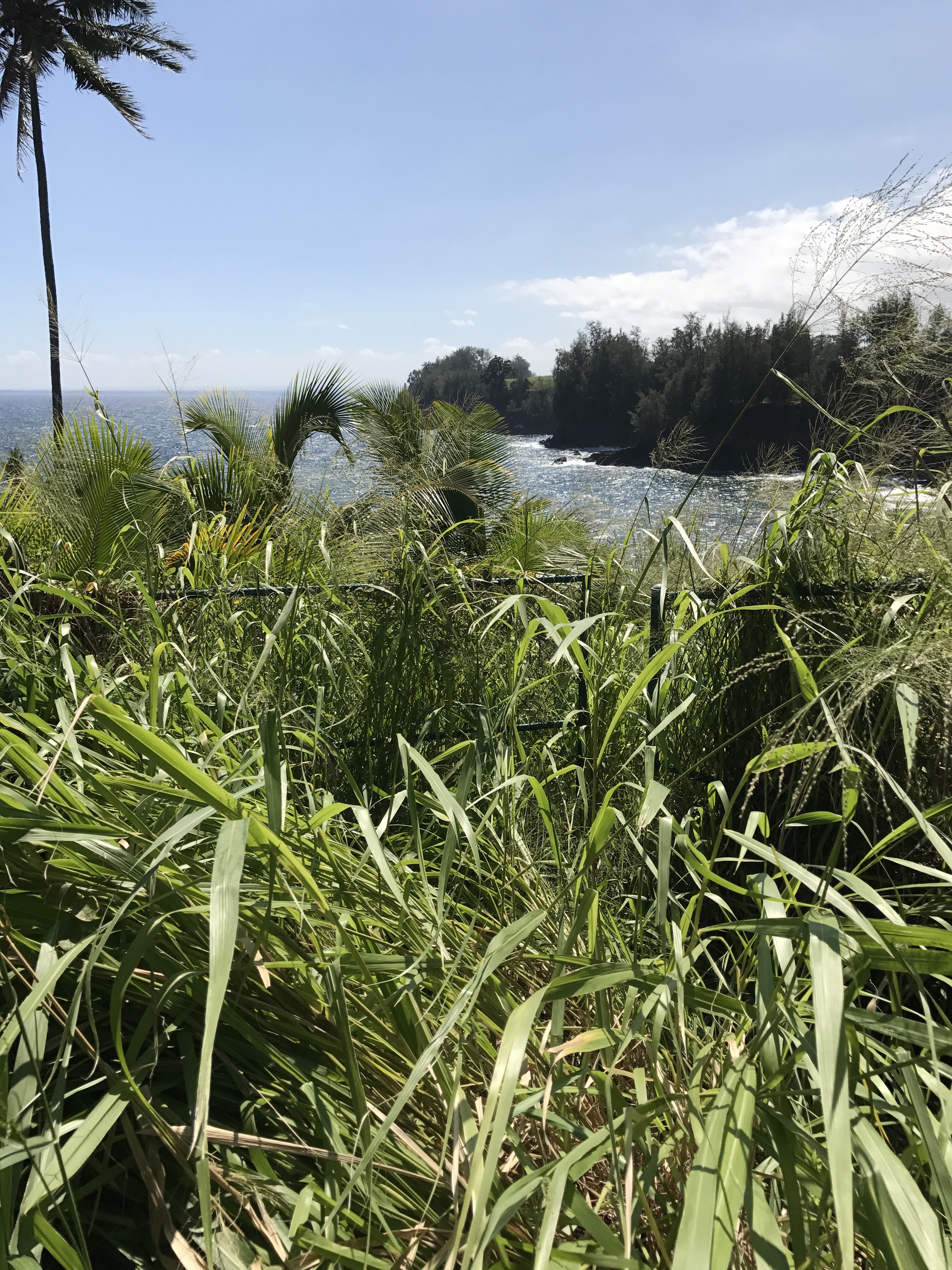
The issue of public access along the Pepe`ekeo shoreline, about 10 miles north of the Big Island town of Hilo, has been contested for two decades or more. No sooner does it seem to be settled than it flares up again. The flash point this time – as on several past occasions – is the entry to a gated subdivision, at a lot owned by Hilo Project, LLC, whose two members are Gary Olimpia and Scott Watson, and also by Watson individually. Watson is a builder who has run up against county Planning Department requirements numerous times over the last decade; Olimpia is a California lawyer.
The most recent incident resulted in the county issuing a notice of violation in late August over blocked access. Olimpia and Watson contested the violation. Their appeal was heard by the county’s Board of Appeals at its meeting on November 9. After a day-long meeting where that appeal was the only item considered, the outcome was anticlimactic: the board merely kicked the can down the road.
A Short History
When most of the coastal lands in the area were owned by the sugar subsidiary of C. Brewer, fishermen were freely allowed to use plantation roads and trails to get to the water. Once the plantation closed in the mid-1990s, access continued for another few years until a new owner, Continental Pacific, proposed developing the prime area along the coast into an upscale, gated subdivision.
Following numerous community meetings and negotiations, a plan for public access to the shoreline and also to two small cemeteries in the area was developed. It was incorporated into the Special Management Area (SMA) permit No. 450 issued as a condition of the subdivision; both preliminary and final subdivision maps identify the easements for public parking as well as for pedestrian shoreline access.
Since at least 2012, however, Watson and Olimpia have sought to relocate the pedestrian easement. The foundation for their proposed 7,200-square-foot “Pepe`ekeo Palace” extends to the very edge of the easement; according to a site plan Hilo Project delivered to the county, the eaves of the proposed house will extend over the easement. Unless the access is rerouted, future homeowners could have their ocean views from the marble-tiled lanai interrupted by fishermen and hikers just inches away, beating a path to the shore.
Not only does the house site extend into the pedestrian easement, it also encroaches well into a 40-foot-wide setback from the top of the small pali, or bluff, that rises up from the ramp leading to the water’s edge. That setback also was established as part of a condition of the subdivision permit.
As Enviroment Hawai`i has reported, starting in 2012, shortly after Watson began foundation work on the house, the pedestrian access was “temporarily” relocated by him so that it now runs north of the lot, along a paved drive that Watson has poured, joining up with the coastal path a couple of hundred feet from where it officially lies. This is the path the public has been using since then. The legal access has been allowed to become overgrown and a locked gate in a fence around the construction site had until recently prevented the public from following the easement as it is described in deeds and subdivision maps.
A Stalled PCR
According to Steve Strauss, attorney for Hilo Project, Olimpia made the call in June to close off the rerouted shoreline access out of frustration with the county not having approved his proposed parcel consolidation and re-subdivision (PCR). Watson and Olimpia have claimed that the original lot boundary was drawn in error and that the PCR is required to correct that mistake.
In addition to fixing that alleged error, the proposed PCR would make the so-called temporary access permanent so that it follows along a driveway Watson, anticipating approval of the PCR, poured on property owned by his neighbor to the north, Continental Pacific. In return for allowing the access to be relocated onto its property, Watson and Olimpia have offered Continental Pacific a similarly sized slice of land nearer to the coast.
In addition, the PCR would move further inland the mauka boundary of the Hilo Project parcel, shifting it toward the road over land owned by the Pepe`ekeo Point Shoreline Association, representing subdivision homeowners. The PCR would also add more than half an acre to Watson and Olimpia’s lot, increasing its size to 1.753 acres, mainly by folding the shoreline ramp to the sea into their parcel.
The PCR application has been stalled for years. One of the hold-ups mentioned by Strauss has been the series of violations that Watson and Olimpia have racked up since 2012. The PCR application can’t be processed until the violations are resolved. It is also unclear if the neighboring owners have properly given their consent to the proposed boundary amendments. While they had years ago given their consent to the PCR sought by the lot’s previous owner, as recently as last month, the homeowners’ association rejected Strauss’s claim that “there exists no dispute between the association and Hilo Project.”
Strauss testified that “because the PCR was stuck, the owners said we can’t keep it open anymore,” referring to the pedestrian access along the driveway.
On June 26, Strauss delivered a letter to the Planning Department requesting a “date certain” when the PCR would be approved. Otherwise, “the public access will revert to the legally established location,” the letter stated.
By July 11, access down the driveway had been closed off, Watson had erected a fence on the homeowner association land fronting the Hilo Project lot, and the gate in fencing around the construction site remained locked. In short, there was no way, legal or otherwise, for members of the public to get to the shore.
The Notice of Violations
After visiting the site, the Planning Department issued a notice of three violations to Hilo Project and the homeowners’ association on August 24. The department found that Hilo Project had illegally blocked public access by 1) stacking tree trunks within the easement, 2) erecting a hogwire fence over the homeowner association property, and 3) locking an interior gate. The landowners were required to remove the new hogwire fence, clear vegetation and debris from the legal access route, and keep the now-locked gate open. Planning Department director Michael Yee assessed a fine of $1,000 for blocking public access and ordered corrective action to be taken by October 1. After that, he wrote, “Daily fines of $1,000 per day shall begin to accrue … if the violation is not corrected.”
In his appeal, Strauss argued the hogwire fence had been cut to allow the public through, so that this was no longer at issue. Also, he conceded that his clients had locked the interior gate and offered to have his clients pay a fine of $250 in settlement of that.
As for the logs stacked across the legal pedestrian easement, Strauss argued that the county is barred from pursuing that as a violation. A deal he struck with then county planning director B.J. Todd back in May 2013 prevents the county from citing this as a violation, Strauss claimed.
The county had knowledge of the logs as early as March of that year, he stated. “By agreement between Hilo Project, LLC, Scott Watson, and the Planning Department May 6, 2013, the Planning Department declared that it had notified landowners of all known or suspected violations of county law, regulations, and rules by landowners with regard to the subject property as of the date of that agreement. … The Planning Department cannot now lawfully claim that this pre-existing condition constitutes a violation,” he told the board.
Michael Kagami, the deputy corporation counsel representing the Planning Department at the BOA meeting, disputed this.
“It sounds to me they’re admitting it’s a violation. The logs are there, blocking public access. The only disagreement is, does the agreement in 2013 prevent the department from assessing a fine? … The settlement agreement just doesn’t cover access. And nowhere in the agreement does it say if it’s a violation now [in 2013] we can’t pursue it in the future,” he said.
Nonetheless, Strauss went to great lengths to get Darrow, the staff planner, to acknowledge that the logs had been in the warehouse foundation area of the easement since at least 2012, when their presence was noted in an archaeological survey.
“There’s no dispute that the photos of debris shown [in the survey] existed as of February 2013,” Strauss said, asking Darrow for confirmation.
“Correct,” Darrow replied.
Strauss then pointed to language in the 2013 agreement stating that the planning department had “notified landowner of all known or suspected violations of county law, regulations and rules by landowner to date.”
“Isn’t it fair to say that if the county considered [the logs] to be a violation in that area and already had notice of it in 2013, it never notified the owner at the time of entering the agreement that it considered it a violation?” Strauss asked Darrow.
Darrow: “I would disagree.”
Strauss: “The county didn’t notify us in 2013, did it?”
Darrow: “I notified you in 2012, which was prior to this agreement.”
Strauss: “So … there’s no dispute that the county was – if it ever considered this a violation of public access, it didn’t consider this at the time she [Leithead-Todd] signed” the agreement.
Darrow: “You got the notice of violation four years later.”
A Secret Easement?
In an effort to explain to the BOA how the messy situation developed, both Watson and Olimpia claimed they had no knowledge of the SMA permit for the subdivision and the public access easement across the property until after they purchased it. Watson said that the SMA permit wasn’t in any public record.
Olimpia testified that before he purchased the property in February 2008, he went to the title company and had all public records pulled. “I looked at those, looked at the CCRs [covenants, conditions, and restrictions of the subdivision association]. There was no reference to any settlement agreement between Continental Pacific and the county. I went to the Planning Department and asked to pull all the records [for the lot].
“For a day and a half, I went through every box. Nothing. No reference whatsoever to that settlement agreement. I wasn’t provided that settlement agreement. I had no knowledge of that settlement agreement.
“I purchased that property from good friends, Mr. and Mrs. Alderson. They had no knowledge of that settlement agreement. The only document I had was the subdivision map,” he said. This, Olimpia claimed, did not show the pedestrian easements.
Deputy corporation counsel Kagami pressed Olimpia on this point. “Did you have any knowledge of SMA 450?” Kagami asked.
“No, I never knew it existed. It wasn’t in any of the public records I went through – a couple thousand pages,” Olimpia answered, going on to say: “It was in a sealed file that later I was told about after all the problems.”
Kagami then asked, “With respect to public access, wouldn’t that be in the deed?”
“It is not,” Olimpia replied. “It’s only in that settlement agreement, [SMA permit] 450,” which, he said again, he never received.
BOA member Steven Hirakami seemed incredulous that mention of the easements would not be included in the deed. “You state this easement is not in the deed?” he asked Olimpia.
“That’s correct.”
Staff planner Darrow was then questioned about the setback and easements.
Kagami: “With respect to SMA 450, is that a public record?”
Darrow: “Yes, it is.”
Kagami: “Can you address why Mr. Olimpia did not have access to the easement record?”
Darrow: “I can’t say what’s in his deed, with respect to documents in the Bureau of Conveyances. But a simple check of the TMK [tax map key] of the property or subdivision that created the parcels would identify the public access easement on his property as well as for the entire subdivision….”
Kagami: “So the public access easements we’re talking about today, they’re in the subdivision maps?”
Darrow: “Further than that, when SMA was approved, it was for the 11-lot subdivision, which parcel 151 [the Hilo Project lot] is a part of. That subdivision identifies those public access easements.”
Strauss asked Olimpia whether Darrow was correct about the easements being identified on the subdivision map.
“He’s wrong,” Olimpia said. “The subdivision map does not describe any public access. I’m a lawyer, I’m not going to tell you something that’s there isn’t there.”
Three hours into the meeting where the Hilo Project was the only substantive item on the agenda, the Board of Appeals broke for lunch, but not before asking Planning Department staff to track down the property deeds as well as the subdivision maps.
About an hour later, when the board reconvened, Darrow distributed the February 2009 deed conveying the final 25 percent of the property from Richard Alderson to Hilo Project and the later, September 2009 deed transferring ownership from Hilo Project to Hilo Project and Scott Watson.
In both deeds, there are clear references to the parking, pedestrian, and other easements.
Nor do the subdivision maps support Olimpia’s claim. The deeds reference a map prepared by Ross Tanaka. That map, which Darrow presented to the BOA, was a preliminary subdivision plat map.
Darrow also brought with him a copy of the final subdivision plat map.
Strauss and Olimpia attempted to make much of the fact that the deeds refer to the Tanaka map – instead of the final subdivision map – and suggested this could explain why Olimpia had no knowledge of the pedestrian easement.
In fact, the pedestrian easement is identical on both maps, which clearly show where the easement enters the Hilo Project lot from the parking area and ends up at the coast.
Wrapping Up
The four members of the Board of Appeals present at the November meeting seemed puzzled by the obvious acrimony among the parties and the apparent inability of Hilo Project and the county to resolve not just access issues but those involving setbacks and the proposed parcel consolidation and re-subdivision as well.
Kagami replied that the county had attempted to come to a resolution on the access issue as recently as October. “From the Planning Department perspective, there was an agreement to have driveway access. The department wrote a letter and sent it to Mr. Strauss. Mr. Strauss didn’t agree to it. So we’re in a position where that’s what we said okay to, but they didn’t want it.”
Strauss ascribed the problems to people in the Planning Department who had an animus against his clients. “The county has used this violation to leverage my client as they’ve used prior violations to leverage my client,” he said. “It’s like whack-a-mole. And I’ll tell you why. There are persons in the Planning Department who hate this guy, Mr. Watson. That’s the history of why these things keep popping up after years and years.
“So you enter into negotiations with the planning director, and then he’s gone. … We still hope we can solve globally all issues with Mr. Yee and provide that access. But we’re being asked to provide that access without them moving forward on our lot consolidation. What they don’t tell you is they’re trying to negotiate access with Continental Pacific. You do have persons inside the Planning Department that don’t want this project built.”
The Board of Appeals had just four of its authorized seven members present at the November meeting and under its rules, all four, as a majority of its authorized membership, had to agree to pass any motion. But in the event that did not occur, the board’s rules allow for the chair to continue the hearing to a meeting where more members are available to vote.
Deputy corporation counsel for the board, J Yoshimoto, explained: “The board rules provide, in this case, because we only have four votes, and if we don’t get this, then the board chair has discretion to continue to a meeting where we have more… If you decide not to defer the petition, then Mr. Strauss can appeal to Circuit Court. The violation remains.”
In the end, the board voted three to one, with chair Dean Au casting the dissenting vote, on a motion to dismiss the violations. Au then exercised his option to have the matter heard again by the Board of Appeals. It’s scheduled to come up at the board’s January meeting.
— Patricia Tummons
For Further Reading
Environment Hawai`i has published numerous articles on this issue since December 2012. Here are a few:
- “Shoreline Easement Lost as Builder Racks Up SMA Violations,” December 2012;
- “Hawai`i County Sends Violation Notices to Builder over Construction at 2 Sites,” January 2013;
- “Hawai’i County Is Challenged In Court Over Ability To Determine Coastal Setbacks,” June 2013;
- “Hawai`i County Keeps Negotiating with SMA Violator, Despite Court Ruling,” March 2014;
- “Hawai`i County Panel Refuses to Approve Change in Setbacks for ‘Pepe`ekeo Palace,’” October 2014.
Leave a Reply